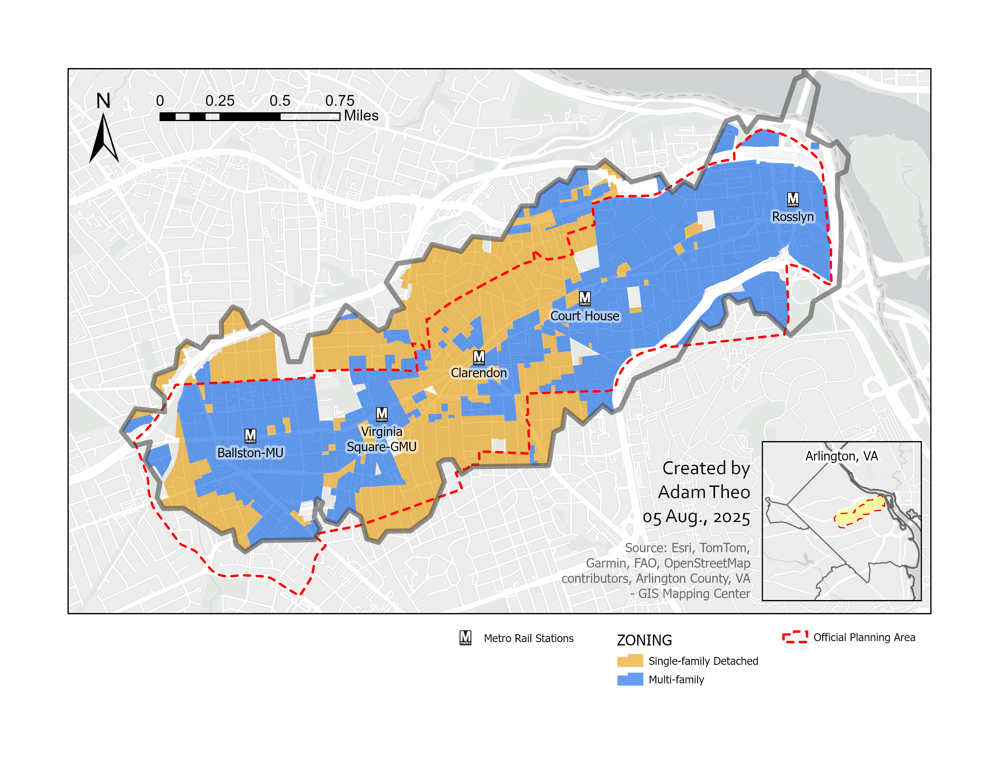
One perk of taking a Geographic Information Systems course at GMU for my new degree: I now know how to make professional maps. One perk for you: you get to see them. Here's one I created for my final project, exploring a question I'd long wondered about—how much land near Arlington’s Rosslyn-Ballston Metro stations is under-utilized due to single-family exclusive zoning?
This corridor is unique. When DC’s Metro expanded in the late 1970s, Arlington officials insisted it run underground through neighborhoods rather than along I-66. That decision enabled one of the country’s earliest experiments in Transit-Oriented Development (TOD): apartments, shops, and amenities clustered around train stations. Rosslyn and Ballston embraced the model, with Ballston becoming the densest census tract in the DC region. But elsewhere along the corridor, homeowner influence has kept zoning low-density.
With Arlington — like much of the country — facing a housing affordability crisis, it’s vital to build homes where people have access to transit and opportunity. Zoning that blocks this harms our community and deepens the crisis.
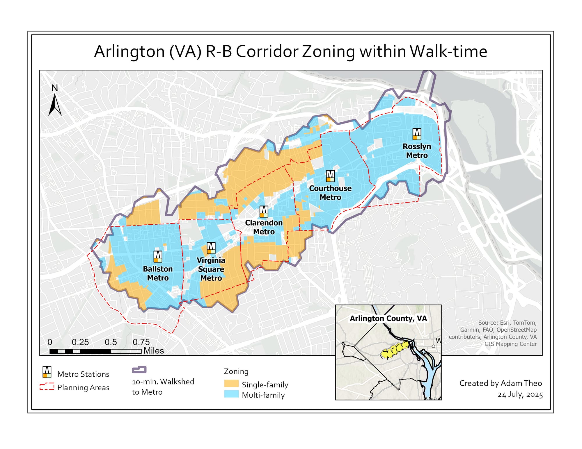
This map shows two broad residential zoning categories in Arlington: single-family (detached homes only, with one exception noted earlier) and multi-family (townhouses, apartments, condos, and other dense housing types). It covers a 10-minute walkshed—roughly half a mile—from each of the five Metro stations, and includes the county’s official planning areas around those stations.
As you read the map, note the large swaths of exclusionary single-family zoning north and south of Clarendon and Virginia Square, especially in Lyon Village, Lyon Park, and Ashton Heights. These neighborhoods consist of expensive homes within easy walking distance of Metro and TOD amenities, yet zoning locks them out of more transit-aligned uses. Also note the mismatch between the walkshed and the county’s planning areas—some walkable zones fall outside the designated urban corridor.
The map was built using Arlington’s open data portal, including “Zoning Boundaries” and “Planning Areas and Corridors.” Metro station locations came from MWCOG’s open data, though I adjusted Court House’s coordinates to correct for a one-block error and account for multiple entrances along Clarendon Blvd, Wilson Blvd, and Courthouse Plaza.
Note: While R-5 zoning technically allows duplexes on lots over 8,700 sq/ft next to commercial parcels, the criteria are so restrictive that no duplexes have actually been built under it. So for this map, R-5 is categorized as single-family detached. Also note: The map reflects zoning, not current land use. Some buildings don’t match their zoning due to grandfathering or site plan exemptions—like a church near Virginia Square on an R-5 lot, or an apartment near Clarendon zoned for a hotel.
I originally shared the map on Bluesky, LinkedIn, and in the YIMBYs of Northern Virginia Facebook group, where it received great feedback and engagement. A refined version now appears in the second edition of the MAXIMUM A-R-L zine, published by my friend @ArlingtonAF.